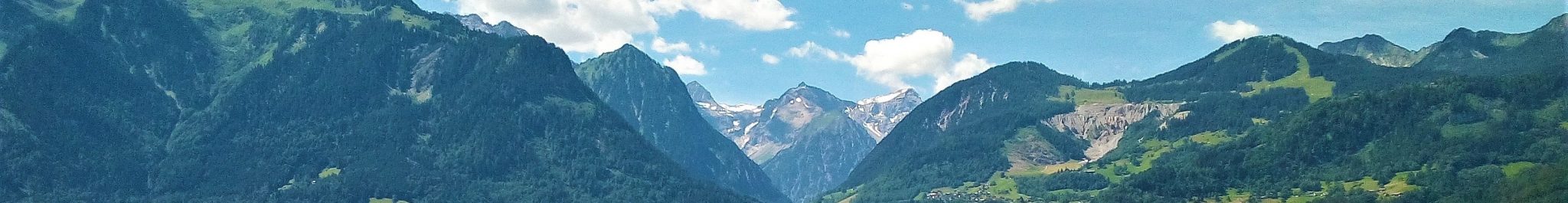
Lech
The municipality of Lech is situated in the mountains of the Lechquellengebirge and Lechtaler Alpen in eastern Vorarlberg. It is largely within the upper reaches of the catchment of the river Lech and its tributary the Zürsbach in the drainage basin of the Danube. The slopes of the Mohnenfluh-Juppenspitze and Karhorn-Auenfelder Horn mountains in the north-northwestern part of the municipality belong to the catchment of the Bregenzerach, which flows via the Auenfeld pass to the west; it is part of the drainage area of the Rhine. A small area to the south of the Flexenpass in the southeastern corner of the municipality also belongs to the catchment of the Rhine.
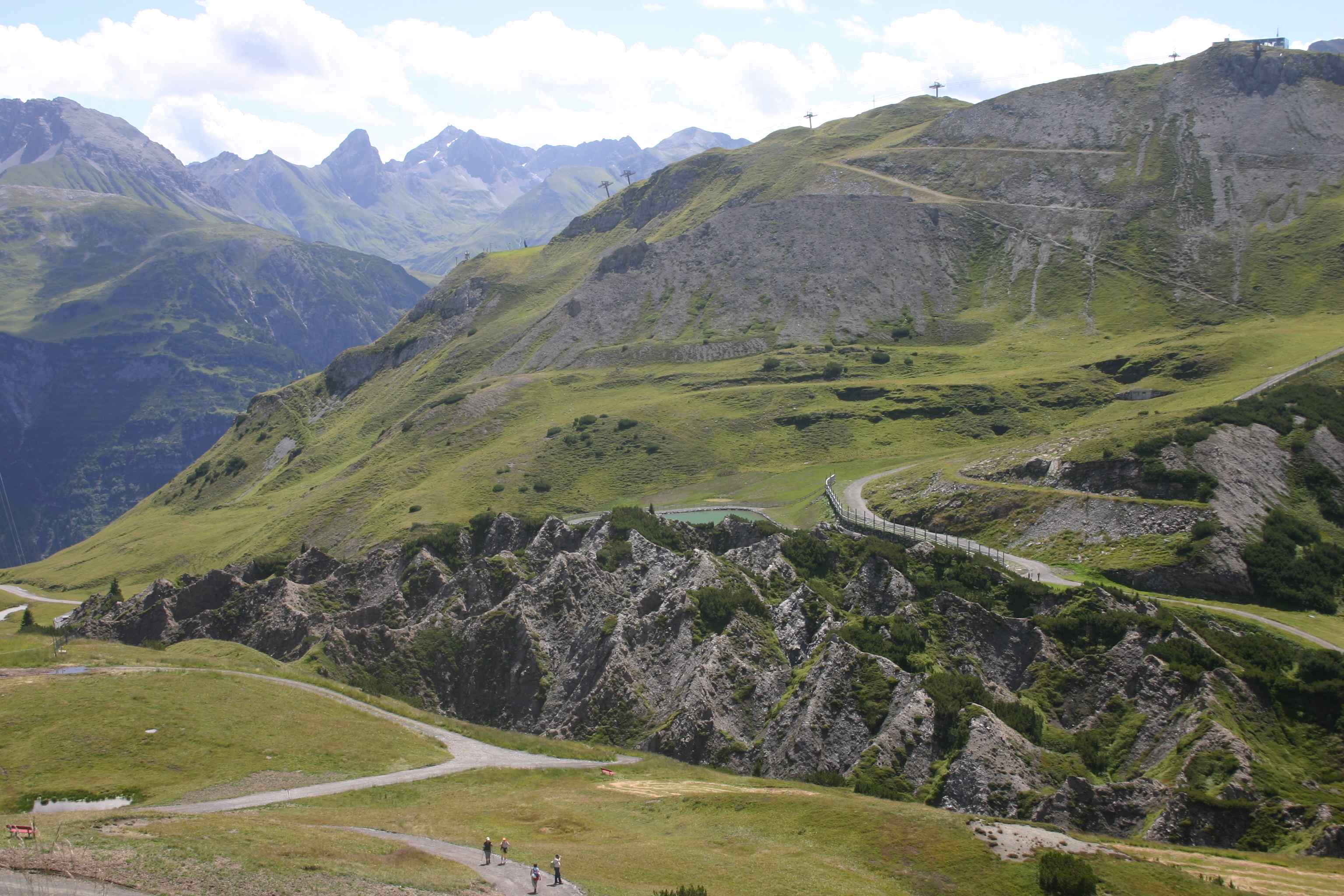
The highest point is at the Valluga summit (2809 m) in the southeastern corner of the municipality. The lowest point is at 1340 m in the incision of the Lech in the northeastern part. The centre of the municipality is a relatively open landscape, surrounded by high-alpine mountain topography: the mountain chain of Mohnenfluh-Braunarlspitze-Hochlichtspitze in the west, the Omeshorn-Wildgrubenspitze-Grubenjochspitze divide in the south, and the Valugu-Trittwangkopf-Wösterspitze-Rappenspitze divide in the east. It is sometimes called a “pass landscape”: the Auenfeld area in the north opens to the lower lying area of the Bregenzerwald, the Flexenpass south of Zürs to the Klostertal.
Glaciers have played a key role in the landscape development of the Lechquellengebirge and Lechtaler Alpen, but at present only remnants of glaciers are left. Two small glaciers – or firnfields – are left within the boundary of the municipality. The Pazüelferner lies at about 2500 m altitude on the northern slopes of Pazüelfernerspitze, at the head of the Pazüeltal in the southeastern corner of the municipality. The other remnant glacier lies in the north-exposed cirque to the northeast of Untere Wildgrubenspitze (2753 m).
The Lechquellengebirge and Lechtaler Alpen were a major feeder area in Vorarlberg of the glaciers of the ice ages. Due to the high elevation and high precipitation, glaciers formed early and merged into an ice sheet covering the high mountains. From this sheet, glaciers flowed via the passes and the lows between the mountains to the lower reaches of Vorarlberg and into southern Germany. For the same reasons, the area became deglaciated relatively late. Unsurprisingly, glacial-erosive landforms dominate the landscape. Moraines occur, but are not widespread. Glaciofluvial landforms are very subordinate. Landforms due to mass movement are abundant, a common feature of a high-relief mountain landscape. Fluvial activity occurs: fluvial incisions modify the glacial topography, while fluvial accumulations are subordinate. Karst has locally formed eye-striking landscapes. The gypsum karst dolines (Gipslöcher) of Oberlech are well-known and well-documented. Remarkable is the Karrenfeld, a carbonate-karst feature, east of the Rüfikopf summit.
A selection of valuable landforms and deposits (see Geodiversity-Geoconservation) is presented here. Some of these are important for understanding the landscape development, notably as indicators of past climate change; others are textbook examples of landscape-forming processes. The Auenfeld-Hoher Bühel area is a relatively open landscape with an overall saddle shape; as such and because of the large diversity of landforms it is a rare high-alpine landscape. The river Zürsbach did not always flow along its present-day course: an abandoned channel/valley is preserved at Omesberg. Whereas the latter feature may be easily overlooked in the context of geoconservation, the gypsum dolines of the Oberlech-Kriegeralpe area stand out as rare and exemplary landforms of karst in sulphate-bearing rocks.
The Auenfeld- Hoher Bühel Area
The Auenfeld-Hoher Bühel area shows a large variety of landforms over a short distance (see maps and photos below). It is a large saddle: the highest point in the west – outside the mapped area of the maps – is at the Juppenspitze-Mohnenfluh divide (2542 m) and in the east at the Auenfelder Horn-Karhorn mountains (2416 m); the lowest point in the north is at about 1650 m in the Auenfeld, whereas the confluence of the Gaisbach and Kitzbach is the lowest point in the south (circa 1480 m). The highest point of Hoher Bühel is at 1835 m. High-alpine glacial cirque-like landforms occur as well as forms which are usually found at lower altitudes: the relatively wide alluvial-fluvial valley floor of Auenfeld, and the swarm of hills of the Hoher Bühel plateau, which were formed by glacial erosion of the bedrock. Considering the large geodiversity, both on a detailed and a large scale, the area as a whole is a rather unique mountain landscape.

Digital polygonal geomorphological map (left) and potential geoconservation map (right) of the Auenfeld-Hoher Bühel area. For legend of geomorphological map refer to level Tier 3 of hierarchical Geomorphological mapping. For an explanation of the geoconservation assessment refer to Geodiversity-Geoconservation. The geomorphological map is displayed as a semi-transparent overlay on a DEM-derived hillshade map.
Morainic ridges and associated erratics occur in several places: at Obere Gaisbühelalpe and at Untere Gaisbühelalpe in the southeastern corner of the above map, and at the confluence of the Kitzbach and Gaisbach. These moraines are thought to have been deposited by the former Mohnenfluh Glacier, which at the end of last glaciation‚ emerged on the eastern slopes of the Mohnenfluh-Juppenspitze divide out of the disintegrating ice sheet which once covered the entire area. The moraines represent local stages of a spasmodically receding glacier. Note that the morainic ridges at the upper station of the Rotschrofen ski lift also belong to this series.
The low of the Auenfeld (see photo below) has been formed by glacial erosion in a substratum predominantly consisting of marly rocks of the Allgäu Formation. Remarkable is the alluvial-fluvial fill which was deposited primarily by the Bregenzerach once the ice had disappeared. The course of the Bregenzerach is relatively straight, in coarse-grained sediments. The tributary streamlets entering the low from the flanks on the eastern side meander in relatively fine-grained material derived from the adjacent slopes. Considering its location at high altitude, the relatively large size in combination with the variation in stream types and deposits makes the Auenfeld alluvial-fluvial valley floor a geomorphosite of high significance.
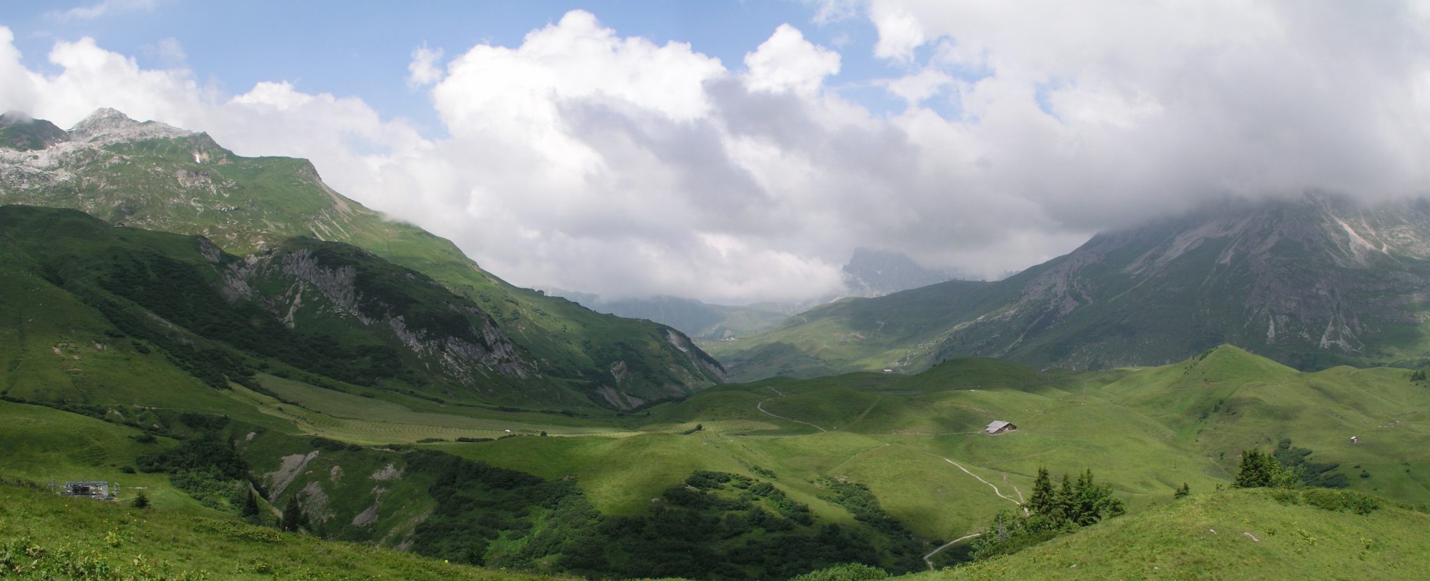

The above photo shows a view to the southeast of the upper part of the Auenfeld and surroundings. A – alluvial-fan terraces of the Bregenzerach in its upper reaches; B – alluvial-fluvial fill of the Auenfeld low (note the Bregenzerach and the small meandering stream to the right and left of “B”, respectively); C – inactive alluvial-fan surface of Untere Auenfeldalpe; D – glacially eroded hills of Hoher Bühel.
Untere Auenfeldalpe is located on the lower part of an alluvial fan which nowadays does not have a distinct feeder channel. The incision lies buried underneath debris produced by a slope collapse of limestone beds of the Oberrhätkalk formation to the southwest of the Auenfelder Horn summit. Present-day activity on the fan being insignificant, it is essentially a fossil feature; it was formed prior to the slope collapse at a time when abundant debris and water – possibly meltwater from a glacier – were produced on the southern flank of Auenfelder Horn. Permafrost conditions may have existed facilitating surface runoff. Disintegrating Oberrhätkalk limestones stand out up-the-slope from the debris. Both mass movement and frost weathering are thought to be responsible.
A major fossil landslide is located to the south-southeast of the forementioned slope collapse feature. Dissimilar to the latter, large blocks and disintegrating rocks are absent. The overall shape is tongue-like. It is thought to originate in the cliffs at the western end of the ENE-WSW running Karhorn divide, as a relatively slow-moving body of debris, possibly under periglacial conditions. A thin layer of debris-flow deposits – some of which are recent – covers the eastern part of the landslide. Good exposures are rare. Unconsolidated material is exposed in a small incision – with an associated small fan at its mouth – at the eastern end of the Auenfeld valley floor. Noteworthy is the very small outcrop of subglacial till at the foot of the landslide along the trail from Untere Auenfeldalpe to Auenfeldsattel: the till is interpreted to extend below the landslide – and, hence, predate it.
The Bregenzerach has formed a series of alluvial-fan terraces in an exemplary arrangement to the northwest of Untere Gaisbühelalpe and adjacent to the forementioned moraines west of this Alpe – a textbook example of how alternating erosion, reworking and deposition create alluvial fans and terraces.
Rounded and elongate hills with wet meadows and small highmoor bogs in between are characteristic of Hoher Bühel (also known as Gaisbühel) and Auenfeldsattel (see photos above). Formed by glacial erosion of predominantly fine-grained rocks of the Alläu Formation, the humps are now subject to shallow mass movement, i.e. solifluction and sliding. The lows between the hills are filled with fine-grained deposits, and poor drainage creates boggy conditions. Resembling a small field of rock drumlins and, moreover, located at an altitude of 1800 m, the swarm of hills is unique in Vorarlberg.
Omesberg – Lech village
The confluence area of the Lech and Zürsbach is strongly affected by human activity: houses and hotels have been built, and constructions have been made to keep road 198 between Lech and Zürs open as much as possible year round. The main geomorphological features are still recognizable; many details, however, have been lost. Nevertheless, it is possible to reconstruct from the remaining landforms and deposits the sequence of events which has created the present-day landscape. The area is an excellent example of how fluvial activity reshapes a glacial landscape, within a setting of large geological structures.

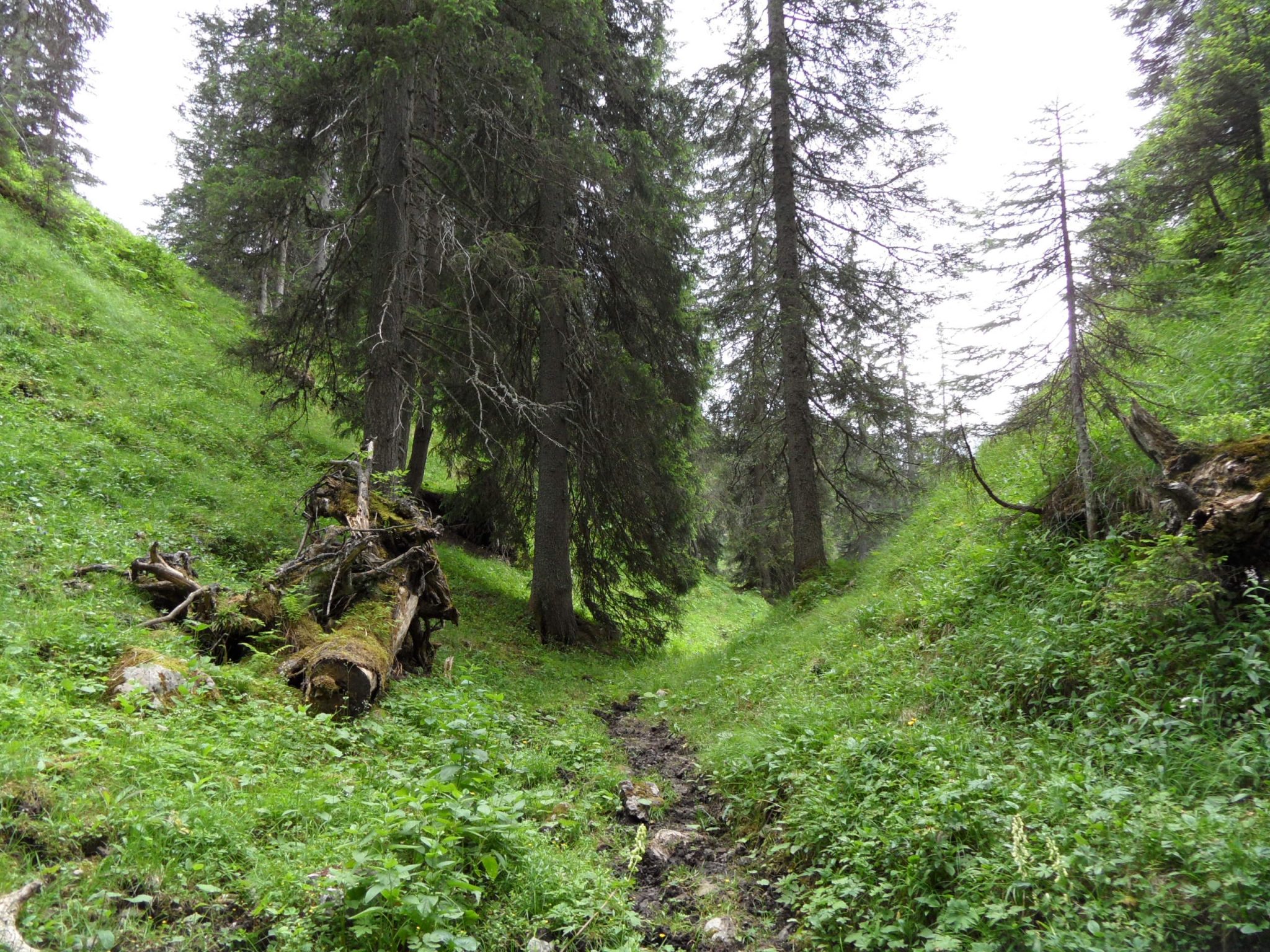
The above photo shows the relatively undisturbed V-shaped dry valley near Omesberg (view to the south).
The figure on the left shows the geomorphological map (top; legend: level Tier 3 of hierarchical Geomorphological mapping) and potential geoconservation map (bottom) of the Omesberg area and the lower section of the Zürstal. The geomorphological map is displayed as a semi-transparent overlay on a DEM-derived hillshade map, the potential geoconservation map on a background of 10 m contour lines.
The Zürsbach flows into the Lech at Omesberg in the village of Lech. The overall orientation of the valley of the Zürsbach is SSE to NNW in its lower reaches, i.e. more or less perpendicular to the geological strike direction, i.e. the main bearing of the geological structures and mountain chains. The Lechtal itself is more or less parallel to the SW-NE geological strike direction. At present day, the Zürsbach downcuts into the bedrock upon entering the Lechtal: it is creating a gorge. The Lech flows in a wide valley floor, reworking an unconsolidated valley fill.
The northern end of the spur between the Lech and Zürs valleys is covered by a thick mantle of subglacial till which is thought to have formed when the area was covered with large masses of glacier ice (see above map). Small exposures of till are found from the lowermost slope adjacent to the Lechtal floor in Omesberg (1475 m) up to about 1725 m on the spur. The slope on the side of the Lechtal from Omesberg up to about 1600 m is only superficially affected by erosion and mass movement. Between 1495 m and 1530 m several SW-NE oriented low ridges occur with gullies in between, which are interpreted as morainic ridges and meltwater gullies formed laterally to the former glacier when the spur had become largely free of ice.
The western flank of the valley of the Zürsbach is strongly affected by erosion and mass movement, in subglacial till and underlying bedrock, making it impossible to exactly reconstruct the original top surface of the subglacial-till mantle across the valley. The lower parts of the eastern slope are being downgraded by shallow mass movements, whereas a relatively thin layer of accumulative slope material covers the higher slopes. The boundary between these different zones of activity is formed by a ledge in the slope, which is interpreted to be underlain by subglacial till – exposed in rare and small outcrops – with a thin cover of slope material, and to have been connected with the mantle of till on the western side of the Zürstal. In other words, subglacial till was deposited below the ice of the last glaciation in an existing Zürstal; subsequent fluvial erosion and mass movement have removed part of this “plug” and created the present-day valley.
Additional and more detailed information on the development of the valley is derived from landforms at Omesberg. A dry valley, i.e. a valley devoid of a stream of corresponding size, cuts in an overall south-north direction through the slope of the Lechtal to the east of Omesberg (see above photo). It begins at 1495 m in the rim of the incision of the Zürsbach hanging approximately 30 m above the river bed. The floor merges about 300 m further north with that of the Lechtal at approximately 1460 m. At an altitude of 1485 m a steepening in gradient occurs; here there was once a waterfall, controlled by a hard layer in the bedrock. The valley was formed by the Zürsbach before it took its present-day course. Due to the subglacial-till “plug” blocking a way to the north, the river created, temporarily, a course to the Lechtal through the slope east of Omesberg. Gradual downwasting of the “‘plug” by mass movement and undercutting opened the present-day north-northwestern route to the Lechtal. The northern course was abandoned and the valley became dry.
Coeval landforms and deposits of the Zürsbach are found upstream. Limestones of the Arlberg Formation create a local base level at the building of the Biomasse-Heizwerk Lech, approximately 250 m from the entrance of the dry valley. Downstream from these buildings the gradient of the river is relatively steep, and the stream is strongly incising. The terrace (1490-1500 m) on the eastern side of road 198 at the Biomasse-Heizwerk Lech is formed in the bedrock; a cover of fluvial sediments appears to be absent. Further upstream, terraces occur consisting of unconsolidated sediments. The terraces were formed in the same period as the dry valley.
Oberlech-Kriegeralpe
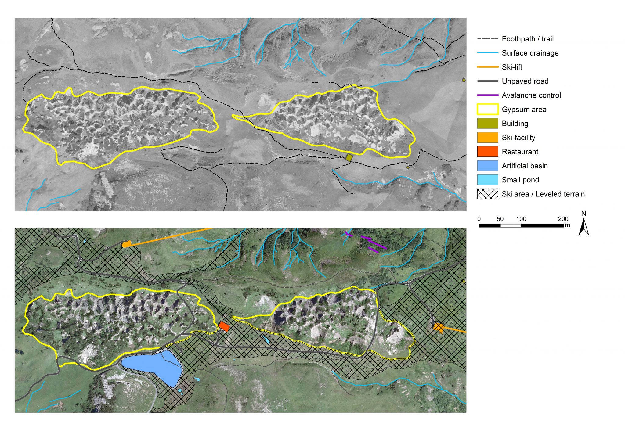
The gypsum dolines (Gipslöcher) of Oberlech and Kriegeralpe are well-known landscape features of the municipality of Lech. They occur in three fields, known as Untere, Mittlere and Obere Gipslöcher. They are all under protection (Naturschutzgebiet Gipslöcher/Nature Reserve Gipslöcher). Karst landscapes like these are rare in Vorarlberg and Liechtenstein, and, hence, are highly valuable contributions to the geodiversity of this part of the Alps. The dolines form in the gypsum beds of the Triassic Raibler Schichten formation. Natural gypsum is a soft, brittle, thin-bedded and easily dissolvable lithology; the layering in the outcrops in Vorarlberg is strongly deformed reflecting their incompetent nature. These characteristics make the gypsum outcrops “vulnerable” not only in a geological sense – rapid disintegration due weathering and strong dissolution, resulting in the typical karst landscape – but also in terms of human interference. Infrastructure improvement, housing constructions and ski runs together exert substantial pressure on the landforms and their surroundings (see figures below). Worth mentioning is that the gypsum doline fields are classified as a biotope of the municipality of Lech.
Literature
If you need assistance in getting access to these publications, please contact us at info@rfase.org
Friebe, J.G., 2007, Vorarlberg. Geologie der Österreichischen Bundesländer. Geologische Bundesanstalt, Wien. 174pp.
Graaff, L.W.S. de, 2014, Die Gestaltung der Landschaft von Lech. In: Ortner, B. (ed.), Gemeindebuch Lech, 16-21. Verlag Gemeinde Lech.
Grass, V. & Grabherr, G., 2009, Gemeinde Lech. Aktualisierung des Biotopinventars Vorarlberg. Amt der Vorarlberger Landesregierung, Abteilung Umweltschutz. 51pp.
Hils, G., Ruff, M. & Czurda, K., 2003, Massenbewegungen im Hochtannberg-Gebiet – Geologie, Ursachen, Beispiele. Vorarlberger Naturschau 12, 31-52.
Krieg, W. & Verhofstad, J. (eds.), 1986, Gestein & Form. Landschaften in Vorarlberg. Hecht Verlag, Hard. 221pp.
Ruff, M., 2005, GIS-gestützte Risikoanalyse für Rutschungen und Felsstürze in den Ostalpen (Vorarlberg, Österreich). PhD-thesis, Fakultät für Bauingenieur-, Geo- und Umweltwissenschaften der Universität Fridericiana zu Karlsruhe, Universitätsverlag Karlsruhe. 132pp.
Ruff, M. & Rohn, J., 2008, Susceptibility analysis for slides and rockfall: an example from the Northern Calcareous Alps (Vorarlberg, Austria). Environmental Geology, 55, 441-452.
Seijmonsbergen, A.C., Jong, M.G.G. De, Graaff, L.W.S. de & Anders, N.S., 2014, Geodiversität von Vorarlberg und Liechtenstein. Geodiversity of Vorarlberg and Liechtenstein. Zürich, Bristol-Stiftung; Bern, Haupt. 304 S. 5 maps. ISBN 978-3-258-07888-5.
Krieg, W. & Waldegger, H.,1985, Die Lecher “Gipslöcher” in naturkundlicher Sicht. Montfort 37 (1), Bregenz, 84-100.