Malbun
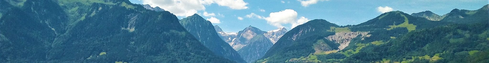
Malbun is a tributary valley of the Saminatal in the southeastern part of the Principality of Liechtenstein, on the border with Austria and to the west of the Gamperdonatal.
The area shows a high-alpine mountain topography similar to the upper reaches of the Gamperdonatal. The highest and southernmost summit is Augstenberg (2359 m) on the divide with the Gamperdonatal. The Malbun settlement is at approximately 1600 m in the valley floor. Present-day glaciers are absent. The general valley and slope geometry is the result of glacial erosion in the past: Malbun is a wide valley with an overall U-shaped cross profile and with cirques and cirque-like hanging valleys in the highest parts, notably in the southwest. The glacial-erosive landscape has been further modeled by glacial-depositional processes, such as the formation of moraines s.l., by rock-glacier formation and by fluvial activity, mass movements and sulphate (gypsum) karst.
The geology, i.e. the structural and lithological variation of the bedrock, is an important factor in understanding the present-day geomorphology of the Malbun region. The variation in landscapes and the distribution of landforms show a distinct link with the lithologies and structures of the Northern Calcareous Alps.
Malbun is an exemplary area for the study of the final decay of a high-alpine glacier network at the end of a glaciation, and, in a kind of mirror image, of the first phases of development of a glacier network at the beginning of an ice age. Cirques are the first areas in mountains to become glaciated and the last to be deglaciated in a glacial-interglacial cycle. The occurrence and extent of a glacier and its moraines contain information about the position of the corresponding snowline or better: equilibrium line altitude (ELA), which is a parameter of climate. Moraines of the past can be used to reconstruct the position of the former ELAs, and thus provide information about the past climate and (rate of) climate change. The Malbun area contains an important and detailed record of past climate change due to the abundance of morainic deposits s.l.
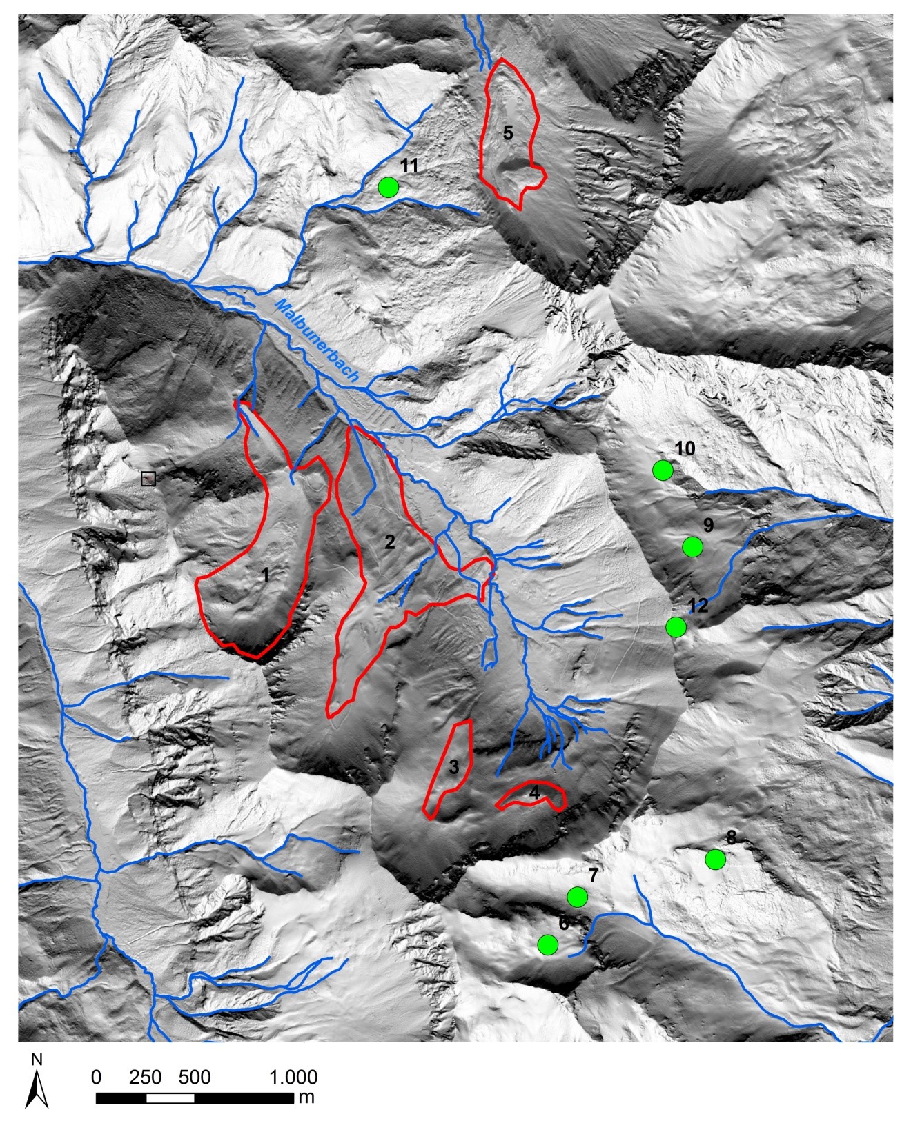
The above figure shows the location map of the sites presented here: 1 Pradamee; 2 Vaduzer Täli; 3 Bärgtälli 4 Steitälli 5. Göra. The information is displayed on a LiDAR-derived hillshade map.
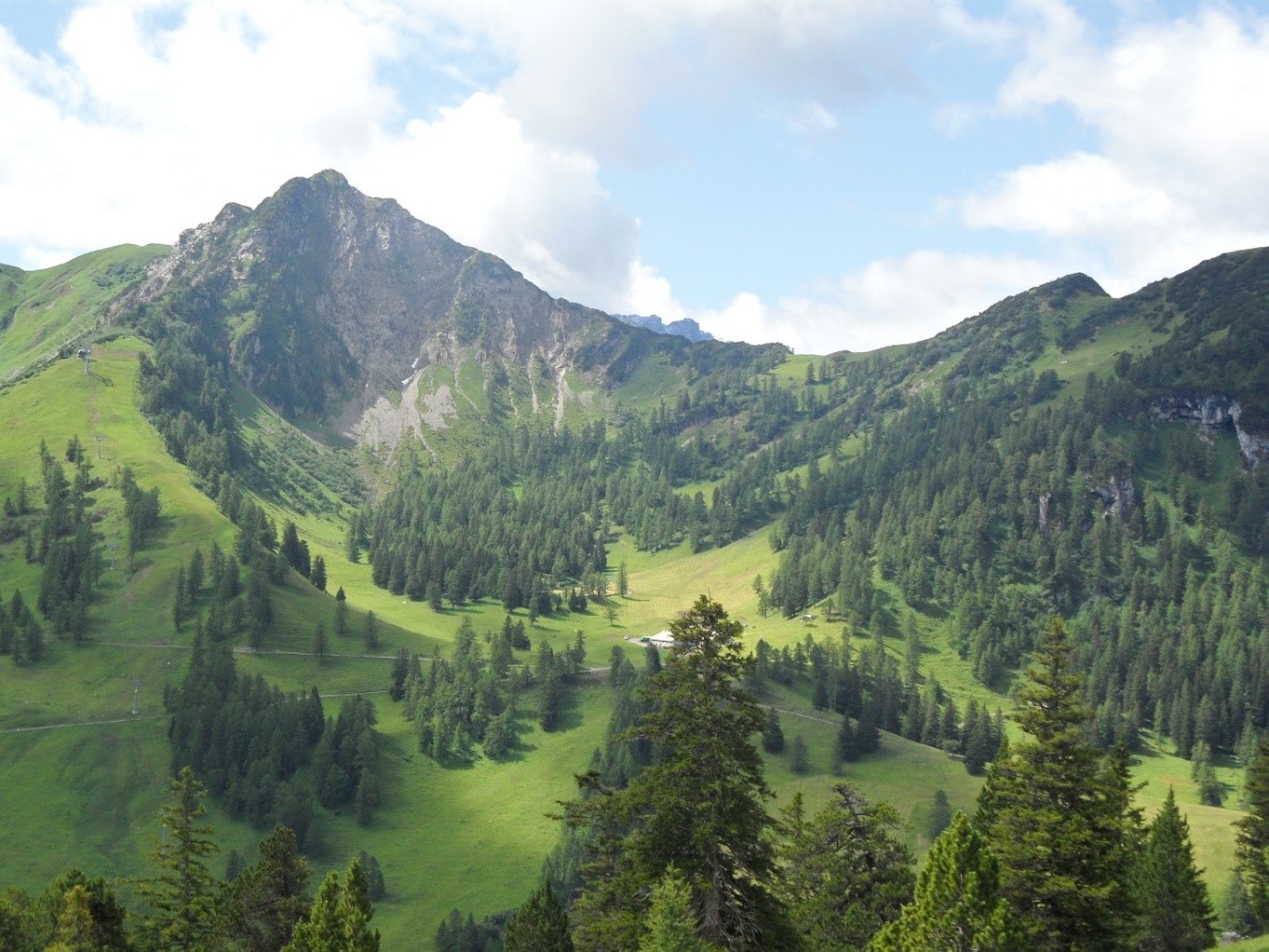
The above photo shows he Pradamee cirque from the northeast. The summit is Nospitz (2019 m). The sharp divide to the right of Nospitz has been lowered by slope failure; the debris fell or slid on the former cirque glacier and was reworked into the moraines which now cover the floor of the cirque (forested area between Nospitz and Pradamee Alpe).
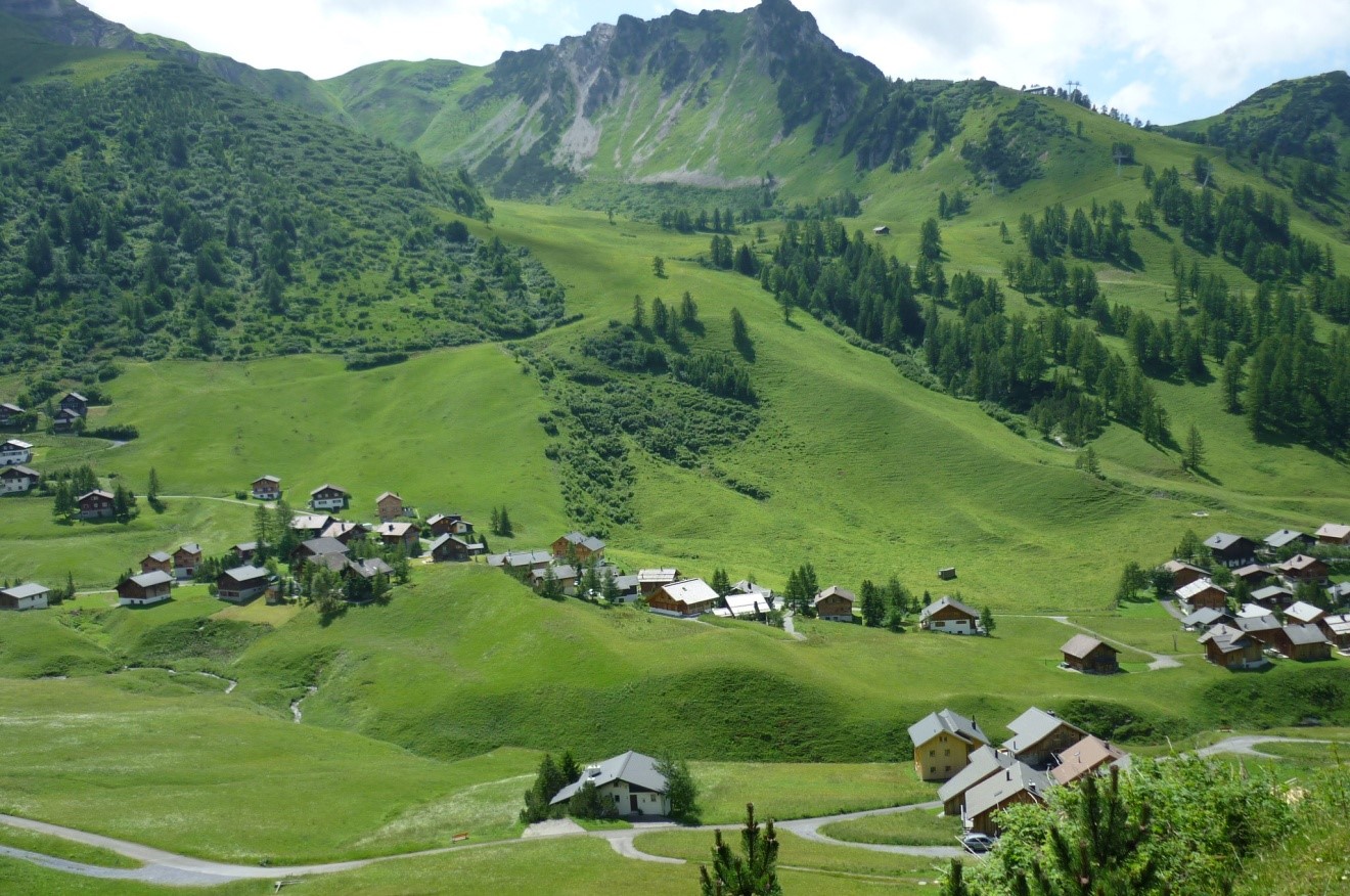
The above photo shows the main valley of Malbun and the Vaduzer Täli cirque from the east. The houses in the centre of the photo are built on relics of moraines of the former Vaduzer Täli Glacier when it was still extending into the main valley. The slope between these moraines and the cirque is covered by slightly younger morainic material which is now being degraded by mass movement. Note the recent cut bank of the Malbunerbach developed in the moraines.
Moraines occur predominantly in the cirques and glacial niches: Pradamee, Vaduzer Täli, Bargtälli, Steitälli and Göra. Some are draped over the thresholds and extend toward the floor of the main valley. Remnants of morainic ridges also occur on the main valley floor, where they are now subject to erosion by the Malbunerbach. Varying in size and located at different altitudes, all moraines have formed within the same time span at the end of the last major Pleistocene (Würmian) glaciation. Most moraines occur in groups with patterns indicative of a sequential formation. They were created during a step-by-step recession of the cirque glaciers in a period of spasmodic climate amelioration. The scientific relevance of the moraines and their prominent position in the assessment of geoconservation potential are, hence, undisputed.
The destructive action of present-day and ongoing landscape-forming processes is clearly visible in the small Schlucher catchment to the east of the Malbun settlement: the interaction of active mass movement, mainly debris-flow deposition, and ongoing dissolution of the gypsum-bearing substratum requires continual remedial work.
Literature
Keller, O., 1988, Ältere spätwürmzeitliche Gletschervorstösse und Zerfall des Eisstromnetzes in den nördlichen Rheinalpen (Weissbad Stadium/Bühl-Stadium). Schriftenreihe Physische Geographie, 27, 2 Bände + Profilkarten, Zürich.
Seijmonsbergen, A.C., Jong, M.G.G. De, Graaff, L.W.S. de and Anders, N.S., 2014, Geodiversität von Vorarlberg und Liechtenstein. Geodiversity of Vorarlberg and Liechtenstein. Zürich, Bristol-Stiftung; Bern, Haupt. 304 S. 5 maps. ISBN 978-3-258-07888-5.
Seijmonsbergen, A.C. and Graaff, L.W.S. de, 2006, Geomorphological mapping and geophysical profiling for the evaluation of natural hazards in an alpine catchment. Natural Hazards and Earth System Science Volume 6, Issue 2, 185-193.
Geological literature
Allemann, F., 2002, Erläuterungen zur geologischen Karte des Fürstentums Liechtenstein 1:25000. Regierung des Fürstentums Liechtenstein. 129pp.
Allemann, F., 1953/1985, Geologische Karte des Fürstentums Liechtenstein 1:25.000. Liechtensteiner Schulbücher Verlag, Vaduz.
Friebe, J.G., 2007, Vorarlberg. Geologie der Österreichischen Bundesländer. Geologische Bundesanstalt, Wien. 174pp.
Heissel, W., Oberhauser, R., Reithofer, O. and Schmidegg, O., 1965/1967, Geologische Karte des Walgaus 1:25.000. Geologische Bundesanstalt, Wien.
Kobel, M., 1969, Erläuterungen zur Tektonik des Rätikon (mit spezieller Berücksichtigung des Kalkalpinen Anteils). Jahrbuch des Vorarlberger Landesmuseumsvereins 1968/69, 245-260.
Oberhauser, R., 1998, Geologisch-Tektonische Übersichtskarte Vorarlberg (mit Erläuterungen). Geologische Bundesanstalt, Wien.
Oberhauser, R., 2007, Geologische Karte von Vorarlberg 1:100.000. Geologische Bundesanstalt, Wien.